Many of us use Google Maps at least once every day. Navigation apps are handy when figuring out new terrain, locating your commute, or finding your way out after getting lost. While the Google Maps application makes it easy to get around in unfamiliar places, it does not have the best reputation for handling user data privacy.
Don’t worry, though. There are, in fact, several alternative platforms that offer excellent map functionalities while prioritizing your data privacy. This article discusses the 13 best alternatives to Google Maps in 2025.
Top Free Google Maps Alternatives: Quick List

Below is the list of the top Google Maps substitutes that you can try:
- Sygic Maps: Handy navigation app that provides real-time updates, including information on traffic, parking spot suggestions, lane guidance, etc.
- Apple Maps: Provides end-to-end encryption of user data and provides features that users expect from apps like Google Maps.
- OsmAnd: Leading privacy-oriented navigation app with features such as Pathfinding and offline map loading. Offers both free and premium versions.
- HERE WeGo: Allows users to move around in real-time. Vast database of points of interest such as restaurants, ATMs, and hotels.
- Navmii: An AI-driven platform that runs on crowdsourcing and open data.
- MapQuest: Stable navigation tool with real-time information on local conditions.
- Waze: Smart, community-driven app with exciting features like live traffic updates, and alerts for dangers.
- Maps.Me: Excellent open-source software with points of interest and up-to-date local conditions.
- Citymapper: Public-transport-focused route planner with offline functionalities.
- OpenStreetMap: Reliable mapping tool with excellent offline functionality.
- Bing Map: A smart mapping tool for Windows devices and PCs.
- Roadwarrior: This application is a professional route planner for drivers and teams.
- ViaMichelin: An up-to-date navigation app for optimizing travel.
Best Privacy-Focused Alternatives to Google Maps: Detailed List
To help save you the stress of this, we examined many navigation apps to see which offers the best experience.
We compared these apps using the best metrics and expected capabilities, including street-by-street navigation, points of interest, reliability, pricing, and behavioral ads. After our evaluation, we devised 13 applications that meet the requirements according to these metrics.
Each tool has its strengths and limitations, so you must examine them thoroughly before making a decision.
1. Sygic Maps

Free + Paid (€19.99/year)
3D offline navigation
Lack of voice instructions on the free version
Features:
- Excellent street navigation
- 2D & 3D maps, both online and offline
- Offers TripAdvisor recommendations
- Location-tailored travel guides
- Advanced navigation features
- Compliance with GDPR rules
- Strict data storage timelines
- Works on Android and iPhone seamlessly
- Offline mode occupies less storage than similar apps
Sygic Maps is an excellent navigation app that offers most of the features you’d expect. The platform was founded in 2004 by a team of Slovaks. It was one of the first companies to create navigation applications for smartphones. By 2015, Sygic had reached a milestone of 100 million mobile downloads. The app provides real-time, high-quality navigation with extra features on the premium plan.
The app can be used online and offline, and users can download information or navigate even in areas with poor connectivity. Sygic works with GPS on mobile phones and tablets, providing door-to-door information for seamless travel. The app’s users can also use 2D & 3D maps online and offline.
In addition to user path data, Sygic provides updated information about live traffic, police radar warnings, parking spots, and gas prices.
Sygic maps is available in 30 languages, including Chinese, Arabic, Russian, and Greek. Besides the mobile app, it provides professional navigation for automobiles and fleets. So, whether you own a car or a ship, you can use the app for travel. For example, Ford, Volkswagen, and Toyota use Sygic’s products. The app also provides TripAdvisor recommendations, travel guides, and other features.
Sygic also offers a premium subscription for its users. The premium plan has offline 3D maps, speed camera alerts, traffic information, and sign recognition. However, not all its features are available on the free plan. Sygic also has strict data storage rules, and they delete your data as soon as you remove the app from your device.
2. Apple Maps

Features:
- Sleek design
- Apple Flyover mode
- Aerial tour of selected cities
- Turn-by-turn instructions
- Accurate weather and temperature reports
- Location sharing
- Ability to pin a location and return in the future
- Privacy-centric navigation
Apple has made efforts to be big on user privacy recently, and its applications have been continually updated to reflect this ideology. Although Apple theoretically has access to a lot of data, it collects less than Google and other tech giants. If you want to protect your privacy, this application will better suit you than Google Maps.
According to the company, the only personal information Apple Maps collects is what is submitted through ‘Ratings & Photos’ and ‘Report an Issue.’ The privacy policy states, “We do not collect personal information associated with your Maps usage, except when you submit information through Ratings & Photos or Report an Issue.”
Apple Maps contains many of the standard functions you’d expect in a navigation tool, along with a slick and user-friendly design. Additionally, the app offers directions in an easy-to-use manner. Whether driving, walking, or taking public transportation, users can receive anticipated arrival times. Apple Maps’ Flyover mode also displays different points of interest in a three-dimensional landscape. Building and structure models are included in this mode.
Currently, Apple Maps offers four different map views: standard, hybrid, satellite, and public transportation. Depending on their preferences, users can flip between any of these displays. Users of the platform can also arrange their travel itineraries. In addition, Apple Maps offers badges for the air quality index, weather, and high-quality real-time information.
Apple Maps also incorporates Siri, Apple’s virtual assistant. This connection enables interactive voice commands within the app. The company interfaces with Booking.com, Foursquare, TripAdvisor, and other businesses for points of interest.
To provide indoor maps for venues, Apple Maps recently incorporated a feature called Indoor Mapping Data Format (IMDF). This feature, which was added to iOS 11, provides comprehensive details about the interiors of buildings found in malls and airports. Users will find it useful in big, unfamiliar places. In addition, Apple Maps offers bike routes in major cities, including New York, London, and Los Angeles.
The fact that Apple Maps is limited to iOS devices, including iPhones and iPads, is one of the main complaints that users may have about the app. However, the service is free on all devices and runs no ads.
3. OsmAnd

Free
Profit model does not require sharing user data
Long load times for the free version
Features:
- Excellent privacy practices
- Does not share user data
- Offline mode with excellent features
- Compliant with GDPR
- Hiking maps
- Open-source code
- Regularly updated maps
- Hiking mode
- Biking paths
- Does not collect personally identifiable data
OsmAnd, which stands for OpenStreetMap Automated Navigation Directions, is a simple yet effective smartphone navigation tool released in 2010. The OpenStreetMap (OSM) database is used by the platform, as its name implies, to render its maps. It is not affiliated with or approved by the OpenStreetMap Foundation, though. OsmAnd utilizes the built-in GPS capabilities of iOS and Android devices to make navigation and directions easier.
Users of this platform can easily navigate by using voice guidance when driving, walking, cycling, or taking public transportation. Additionally, the software computes information like the expected arrival time. When users decide to proceed in a specific direction or to a different location, it also permits automatic rerouting. The platform does not support real-time public transportation arrival. However, it supports lane guidance and can display street names and intermediate points.
The app also works as an offline navigation tool. Users can choose the desired data and the required regions when downloading maps to their devices. Users can search files by name, address, and coordinates when using the offline mode. In addition, OsmAnd offers street-level imagery that lets users discover points of interest (POIs), identify place names, and mark certain spots as favorites for later visits.
OsmAnd also comes with paid versions: OsmAnd Maps Plus and OsmAnd Pro. These versions allow users to unlock unlimited maps, slopes, hillsides, and other features. OsmAnd Maps Plus and Pro allow more frequent map updates, map downloads, Wikipedia travel guides, CarPlay, OsmAnd cloud, and more. OsmAnd Maps Plus is priced at €9.99 per year, and OsmAnd Pro goes for €29.99 per year.
4. HERE WeGo

Features:
- Turn-by-turn guidance
- Ability to download maps of countries and regions
- Dynamic ETA calculations
- Voice command
- Speed limit warnings
- Information on traffic conditions
- Comprehensive view of the entire trip
- Support for electric vehicles and finding electric charging stations
- Points of interest
Here WeGo was released in 2012 as Nokia Maps. Shortly after, they revamped the tool and released it as HERE Maps, available on Windows Phone and the web. Since then, the platform has become popular. It now covers over 200 countries, and functions as a reliable web mapping and satellite navigation tool. The app is based on the HERE location data platform, providing in-house data, satellite views, traffic data, and location services.
HERE WeGo is a functional tool that provides turn-by-turn navigation for users online and offline. With it, users can enter a destination address or name, and the app can automatically calculate the distance and direction to that place.
HERE WeGo also works in real-time, factoring traffic data into its calculation to predict a relatively accurate arrival time. It also supports text-to-speech commands, as well as interactive voice navigation.
The platform works fine with public transport data, whether a user plans to use a bus, tram, subway, or train. It also provides walking and cycling routes, offering distance and arrival time estimates. HERE WeGo also provides real-time traffic information in several countries globally, allowing users to get accurate information on local on-road happenings. Although users cannot save locations or destinations offline, this is possible online.
5. Navmii

Features:
- Protects your data
- Offline map
- Integrates with autonomous vehicles
- AI-driven
- Real-time traffic updates
- Global coverage
- Hands-free navigation
- Points of interest
- Local searches
Navmii is a tool that uses AI, crowdsourcing, and open data to provide an intelligent navigation solution for modern needs.
It is a flexible platform that is made to integrate seamlessly with cars and other equipment. The technology facilitates HD map data for autonomous automobiles or vehicles and creates a relatable map for navigation using crowdsourced data and AI.
Navmii only gathers the information required to give users location services. Its navigation is centered around privacy. A smooth user experience is made possible by the various capabilities it offers on a stylish, user-friendly interface.
The main source of mapping data used in the construction of Navmii is OpenStreetMap, which is updated frequently with the most precise mapping data. Moreover, Navmii offers smooth turn-by-turn navigation that directs customers to their destinations.
The platform also offers great offline navigation features. Users can get to their destinations by downloading maps unique to a given location, even without an internet connection. In addition to its excellent mapping capabilities, Navmii offers real-time traffic information so users can plan their travels wisely.
The site also offers several APIs to facilitate navigation. For instance, its Directions API uses incident data to determine the optimal routes for walking or cycling. Its Optimization API supports cycling, walking, and driving, and is great for multi-stop travel. Users can effectively organize their travels with the help of this API.
The platform operates on a business model that does not rely on targeted advertising. Therefore, there is no incentive to collect user data for targeted advertising. Users can enjoy the app experience without hiccups. Navmii is available on various mobile devices, like many other navigation applications, including iOS and Android.
6. MapQuest

Free
Stable mapping product
Less information on privacy practices
Features:
- Stable navigation tool
- Voice navigation
- Points of interest
- Real-time traffic updates
- Compare gas prices (US only)
- Temperature readouts
MapQuest is a stable navigation tool with unique features to provide driving directions and street-level detail.
It is one of the oldest privacy-focused navigation apps and has been criticized by some as not being as accurate in pathfinding as Google Maps. However, this is probably because they are focused on protecting user data. In addition, they’ve been around for as long as Google Maps has been, meaning they’ve created a relatively stable navigation tool.
Besides its navigation capabilities, MapQuest offers unique features that significantly distinguish it from other navigation apps. For example, it provides street-level detail and driving directions for various countries. To know if your country is eligible, there is a dropdown menu on their home page.
MapQuest also provides several travel products for users on the go. One of its exciting features is that it was created to help users compare gas prices in the US, helping them make the most use of their money. The platform offers a search bar for points of interest and supports hands-free navigation with voice commands. The app also provides real-time traffic information to support travel.
MapQuest is offered for free on Android and iOS. Users can also access it through its mobile-friendly website.
7. Waze

Features:
- Community-driven
- User-generated route details
- Real-time traffic data
- Speed traps
- Voice navigation
Launched in 2006 and accessible in 50 languages, Waze is a global community-driven application that provides up-to-date navigation data and exciting integrations for a seamless travel experience. The app, which incorporates user-submitted travel times and route facts to offer information to its users, is also very well-liked by users. The app also gathers users’ map data and traffic information, which is then sent to the Waze server.
In addition, Waze users can edit home numbers, roads, and landmarks and report traffic bottlenecks, accidents, and speed traps. By rewarding users with points, the app encourages users to provide this data. It then makes use of this data to enhance its offerings. Waze can also assist users in finding the most affordable gas station on their path. However, this feature is limited to a few nations. Excellent turn-by-turn voice-guided navigation is another feature that Waze provides.
Along with some new changes and partnerships, the app now lets users customize the voice of their navigation. Morgan Freeman, Kevin Hart, Colonel Sanders, T-Pain, and Arnold Schwarzenegger are among some of the featured voices. Additionally, thanks to the app’s integration, users can access Waze directions while playing music on the Spotify app. The app integrates with Scribd, iHeart Radio, Deezer, and Pandora, and is also free of charge.
Waze has a lot of benefits, but in the past, it has drawn criticism for having security flaws. Furthermore, the platform has been a Google property since 2013. This permits Google to access and utilize user-generated data.
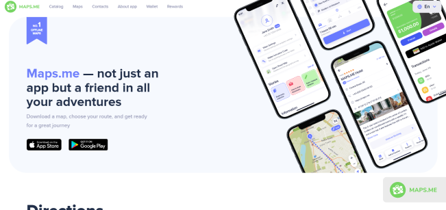
8. Maps.Me

Features:
- Offline navigation
- Turn-by-turn navigation
- Good for driving, walking, and cycling
- Ready-made travel guides
- Real-time traffic updates
- Bookmark locations
An open-source navigation platform built for travel, with ready-made travel guides, traffic updates, and hotel bookings.
Initially known as MapsWithMe, Maps.Me was created in 2014 to help users navigate efficiently. Built on OpenStreetMap data, Maps.Me is an excellent offline navigation tool for individuals and teams. It runs on open-source code, meaning that users have the ability to check where there are any vulnerabilities, allowing for openness.
Besides its offline capabilities, Maps.Me offers a host of features to make navigation seamless. The app offers detailed maps with turn-by-turn navigation, which is accurate for driving, walking, and cycling. These maps are updated daily by millions of OpenStreetMap contributors, allowing for accurate directions.
Moreover, the platform offers ready-made travel guides for users. They’ve created these guides by partnering with content creators worldwide to build a reliable catalog for users. Maps.Me also provide detailed directions to points of interest, hiking trails, and places you’d not find on other maps. Users can also save locations that they love and share with friends.
Besides its offline functionality, Maps.Me also provide real-time traffic updates for up to 36 countries. Users can also search for different tourist attractions and book hotels through Booking.com. However, the app offers targeted ads with user data, though it does not provide third parties with any personally identifying information. Users can use Map.me for free.
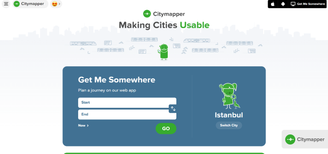
9. Citymapper

Free
Optimized for public transportation
Shares data with riders and city providers
Features:
- Integrated for multiple urban modes
- Public transport navigation app
- Based on open data
- Multiple route modes
Citymapper is a public-transportation-focused application that enables users to find available transport modes between locations.
Note that very few applications support public transportation. It is one feature that makes Citymapper a unique offering. The app is built for navigation through public transit. Through the platform, users can plan their routes according to these services.
Citymapper allows users to compare their travel options through different public transit modes so they can make the best choice. They get this data from public transit agencies like MTA, LA Metro, and more.
After picking their destination and hitting the GO button, users get turn-by-turn navigation instructions for their trips. Citymapper is also optimized for walking, cycling, and scooter trips. Also, the app lets users see how much nearby e-scooters and e-bikes charge.
Additionally, users can compare cab fares, hail a ride, or enter an available scooter. Citymapper offers these services through partners like Uber, Lyft, JUMP, Lime, and Citi Bike.
The app also provides excellent offline navigation in a select few countries, supporting the NYC subway, Manhattan bus transit map, Brooklyn bus map, and more.
The app also integrates with Wear OS watches, allowing users to enjoy their maps on the go. Citymapper’s services require them to share your data with ride providers and city services, which may compromise privacy. The app is free for users.
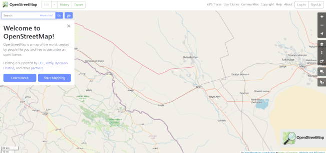
10. OpenStreetMap

Features:
- Open-source
- Offline navigation
- Over a million contributors globally
- Street-level data
- Street-level imagery
OpenStreetMap is a simple open-source navigation app providing high-quality data and imagery for users.
Designed after inspiration from the open nature of Wikipedia, OpenStreetMap is one of the world’s most reliable map tools. The platform works on an open data concept which is run by a global community of volunteers via open collaboration. The app’s contributors gain data from user surveys and aerial imagery and import data from other licensed sources.
OpenStreetMap is the Wikipedia of maps, with many navigation apps building their services on the information that it provides. With the information from this map, users can perform turn-by-turn navigation, carry out humanitarian aid, and visualize data.
The platform uses its built-in topology to collect and store other geographical features. Users can add data to the map on OpenStreetMap through smartphone applications, which are then entered into the database. The platform also gets street-level images from Bing Streetside 360° and the crowdsourced Mapillary and Kartaview platforms. Some governments have also released official data on OpenStreetMap, such as roads provided by the US Census Bureau.
However, OpenStreetMaps doesn’t offer any fancy features and does not have a mobile app. This means that users can only get it on the web. However, it is simple, easy to use, and complies with GDPR. It is also free and offers excellent offline navigation.
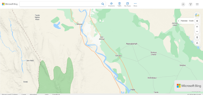
11. Bing Maps

Features:
- Multiple views
- Turn-by-turn directions
- Live traffic conditions
- Save locations
- Plan trips
Bing Maps is Microsoft Bing’s flagship web mapping service, a sleek navigation tool with advanced views and reliable directions.
It was previously known as Live Search Maps and Windows Live Maps. Though the platform has been around since 2005, it only switched to services such as TomTom and OpenStreetMap in 2020. Bing Maps offers exciting features and views that distinguish it from other navigation applications.
On the app, users can access street maps for several cities worldwide, with topographic shading. Points of interest on these maps include metro stations, stadiums, hospitals, and other facilities. Views include a road view, aerial view, bird’s eye view, street side view, and 3D view. The road view is the default, showing vector images of roads, buildings, and other features.
In the aerial view, Bing Maps overlays satellite imaging onto the map. This allows users to see various roads and major landmarks. The app also provides aerial imagery from low-flying aircraft through the bird’s-eye view, showing the sides and roofs of buildings from a better depth of perception. Users can also see signs, advertisements, and other details in this view.
The app also provides streetside views and 3D maps of 60 cities worldwide. In locations such as Chicago, Los Angeles, Spain, and Germany, users can also get public transit directions and view live traffic conditions.
Bing Maps is only available on Windows PCs or browsers and does not have a dedicated mobile app. However, the app is free to use and does not display targeted ads.
12. RoadWarrior

$14.99/month
Available on mobile and web
Only available in selective countries
Features:
- Routing with traffic, schedules, and availability
- Optimizes based on drop-off priorities
- Assign routes to drivers
- Monitor route progress
- Reporting
RoadWarrior is a route planner application for optimizing delivery routes for drivers and couriers, with features for adapting to stops, route progress, and traffic.
It is designed for drivers, couriers, and traveling professionals. Built to offer more functionalities to this set of people than Google Maps, RoadWarrior helps professionals and teams to plan and follow the best routes, avoid wasting time in traffic, and save money on gas.
The software is optimized for individual drivers or teams, with unique solutions for each. With RoadWarrior, users can optimize up to 500 stops each day. Users can get their fastest route in a few seconds by entering their location and destination. The app is also simple to use, only requiring users to download the app and get their fastest route in two steps.
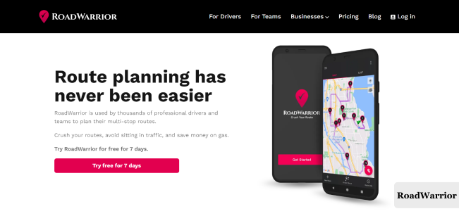
To provide this information, RoadWarrior collects live data on road traffic statuses, using this information to create a custom route to minimize this. They also consider factors such as drop-off priorities, school zones, tolls, and one-way trips. Teams can also plan and track their fleets’ routes, manage drivers, and assign routes in a few minutes.
RoadWarrior has no free plan and is priced at $14.99 monthly for drivers. However, there is a 7-day free trial, and the app does not serve targeted ads.
13. ViaMichelin

Features:
- 3D maps
- Route planning
- Calculates travel costs
- Fuel optimization
- Traffic updates
- Points of interest
- Hotel and restaurant guides
ViaMichelin is a travel-focused navigation app with high-quality information on travel routes, fuel optimization, and points of interest.
The Michelin Group has historically been one of the earliest companies to design and publish maps, long before the advent of GPS and GIS technology. Their web-based solution, ViaMichelin, launched in 2001 to provide map data for users to design and plan their trips. Their website covers over 180 billion kilometers of roads in over 42 European countries. Additionally, users can view maps in 3D, in addition to lite maps, satellite, and aerial mapping.
Besides its detailed maps, the app allows users to calculate their car, motorcycle, and pedestrian routes quickly and accurately, with data on hazard zones, traffic incidents, and speed limits. With this app, you get to find the quickest, shortest, and most direct routes. There’s also an option to know Michelin’s recommended route.
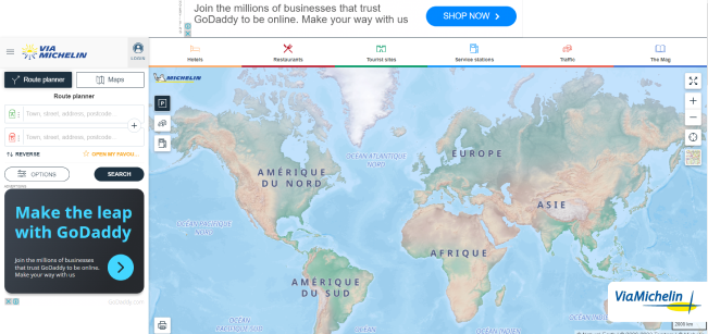
Additionally, ViaMichelin provides users with information on distance, time to travel, and costs (based on tolls, vignettes, and fuel prices). Users can also customize fuel consumption by entering their vehicle model and choosing different routes based on preferences. The platform also helps users find the cheapest gas stations based on their routes.
Users can also get valuable information on points of interest, such as hotels and restaurants. The app is free of charge and available on iOS and Android.
Quick Comparison of the Top Apps Like Google Maps
| Name | Street-by-street navigation | Traffic updates | Offline mode | Availability | Voice commands | Point-of-interest database | GDPR Compliance | Ads | Free trial/plan | Pricing |
|---|---|---|---|---|---|---|---|---|---|---|
| Sygic Maps | Yes | Yes | Yes | Android and Apple devices | Yes | Yes | Yes | Yes | Yes (Both) | Free and Premium+ (€19.99/year) |
| Apple Maps | Yes | Yes | Yes | Only Apple devices | Yes | Yes | Yes | No | Yes (Free plan) | Free |
| OsmAnd | Yes | Yes | Yes | Apple and Android devices | Available | Yes | Yes | No | Yes (Free plan) | Free |
| HERE WeGo | Yes | Yes | Yes | Apple and Android devices | Works with phone’s TTS | Large database | Yes | Yes | Yes | Free |
| Navmii | Yes | Yes | Yes | Apple and Android devices | Yes | Yes | Yes | Yes | Yes | Free and Custom |
| MapQuest | Yes | Yes | No | Android and iOS | Yes | Yes | Yes | No | Free plan | Free |
| Waze | Yes | Yes | No | Android and iOS | Yes | Yes | Yes | No | Free plan | Free |
| Maps.Me | Yes | Yes | Yes | Android and iOS | Yes | Yes | Yes | Yes | Free plan | Free |
| Citymapper | Yes | Yes | Yes (select countries) | Android and iOS | Yes | Yes | Yes | No | Free plan | Free |
| OpenStreetMap | Yes | No | Yes | Web | No | Yes | Yes | No | Free plan | Free |
| Bing Map | Yes | Yes | No | Microsoft devices/web | Yes | No | Yes | No | Free plan | Free |
| Roadwarrior | Yes | Yes | No | Android and iOS | Yes | Yes | Yes | No | Free trial | $14.99/month |
| ViaMichelin | Yes | Yes | No | Android and iOS | Yes | Yes | Yes | No | Free plan | Free |
How Do Privacy-focused Navigation Apps Differ from Google Maps?
Every navigation app provides some privacy features at some level to its users, even Google. However, if you’re concerned about your digital privacy, the standard tools may not suffice. A few distinguishing characteristics make privacy-focused navigation apps more secure with your data than Google Maps. These are:
1. Their Data Collection Policies Prioritize Privacy
Google Maps collects extensive user data, including location history, user preferences, and searches on its website or maps app. All of this is personalized data, which it integrates with the rest of its services. Google then uses this data to serve users targeted advertising or personalized recommendations.
On the other hand, privacy-focused navigation apps only collect as much information as is necessary. Usually, they also anonymize or encrypt your location information so it cannot be traced back to you. For example, in the case of Apple Maps, they scramble (‘fuzz’) your data shortly after you leave their page.
Also, unlike Google, many privacy-focused maps use business models that do not require them to sell targeted ads to advertisers. Some collect subscription fees, such as Sygic Maps and Navmii, while others run on donations. Therefore, you get your data to yourself for a small price, and the business can reliably protect your information.
2. Offline Functionality
Offline functionality is one of the most effective ways to remain anonymous online. However, apps like Google Maps require constant updates and synchronization, which can compromise privacy. On the contrary, privacy-focused navigation apps have robust offline capabilities, allowing users to enjoy navigation capacity without providing their data to a provider. With apps like OsmAnd, users can download maps of entire countries or regions to enjoy high-quality navigation offline.
3. User Control
With applications like Google Maps, user control over the extent of customization is limited. Typically, users have little control over the amount of data that the company collects. And even when there are options to restrict this data collection, there are often hidden weaknesses that they might exploit.
With privacy-focused navigation apps, the company focuses on transparency and user control. Users can adjust privacy settings, delete personal data, and use the map anonymously.
4. Third-party Integrations
Although most companies will vet their potential partners, it is difficult to guarantee what third parties will do with user data. Privacy-focused navigation apps limit unnecessary data exposure with a focus on providing users with a private and secure navigation experience. Applications like Google integrate a variety of third-party apps into their framework. This helps to improve the user experience but also compromises user privacy.
How Do Privacy-focused Maps Protect Your Data?

These apps deploy a wide variety of measures to protect user privacy. While the extent and degree to which each app employs a measure varies, overall, these facilitate improved data security. Here are some of these apps’ strategies to protect your data.
1. End-to-end Encryption
With end-to-end encryption, privacy-focused apps aim to secure the communication between your phone and device. Think of it as preventing others from snooping in on your interaction with your maps app. With encryption, hackers can only decipher your data with the right keys.
2. Deleting User History
For apps that require you to provide some details, it may not be easy to function without collecting some personally identifiable information. However, privacy-focused navigation apps only hold onto this data briefly. They only collect data that is necessary to provide their services, and they typically delete it shortly after a session or on request.
3. Location Anonymization
Some apps do not collect precise coordinates of user locations. Instead, they store aggregated location information on their servers. This makes it challenging to locate specific individuals and keeps your location more secure.
How to Choose the Best Google Maps Alternative

When you open the Play Store or App Store, many options might seem overwhelming. However, it is important to remember some essential tips that would help you make the best choice.
1. Review Privacy Policies
Most of us don’t read privacy policies, probably because they’re so long. However, if your priority is keeping your information private, reviewing this in detail is critical. Privacy Policy is an essential document that details how the app gathers, utilizes, saves, and distributes user data. It’s important to scan the privacy policy for any important information they gather.
This will contain personally identifiable information, device information, and location data. Verify their data-sharing practices with external parties as well. Be cautious if a platform shares a lot of information with outside parties.
2. Review their Data Collection Practices
The type of data the app collects impacts the level of privacy possible for your device. It is important to ensure that the site you’re considering adheres to data minimization principles. Also, you’ll need to look out for how the app handles sensitive data, such as pins, precise locations, and home addresses. If these are unclear, you must be wary of the app.
3. Encryption Standards
Data encryption is one of the most effective ways of protecting your data on the internet. With data encryption, other people cannot access your location data. Even if hackers or third parties intercept it, they cannot make sense of it, allowing you to enjoy unreserved privacy. Typically, you can check their policies and terms for information, such as transport layer security, encryption at rest, and end-to-end encryption.
These protocols ensure that your data is protected in transit and storage and can only be accessed by authorized personnel. A major red flag is if encryption practices are not mentioned in the firm’s documentation.
4. Permission Controls
Most navigation apps will need to collect some sensitive or personally identifying information at some point. However, as a user who prioritizes privacy, you need some control over how the navigation app processes your data. This empowers users to decide how to enhance transparency and user autonomy.
When reviewing these settings, look out for granular and detailed controls. These will include settings to grant or deny access to features such as location services, contacts, and device sensors. You can also ask if they offer just-in-time permissions, only requesting certain data when needed.
5. Check for Offline Functionality
Offline functionality reduces the need for constant connectivity to the internet, which increases the risk of exposing your data to potential security risks. Online maps constantly relay information to servers, reducing the amount of privacy you can enjoy as a user. With offline maps, you can enjoy quality navigation without sharing data.
While exploring the app’s features, check if the app allows you to download maps and navigate offline. Also, confirm if the app can store essential data on your device, minimizing the need for constant updates.
6. Open-source Solutions
Open-source applications are the epitome of transparency in the digital age, allowing the public to scrutinize and check for inefficiencies or inconsistent activity. By providing their code to the public, apps with open-source code enable the community to review and audit the app’s development, ensuring that it follows the best practices.
What to look for? Check if the app provides public access to its source code. A thriving open-source community is also integral to this, as developers can offer suggestions and contributions to improve the quality of the offering.
7. Regular Updates and Audits
Regular updates and audits are signs that a software solution is dedicated to continuously raising the caliber of its offerings. Since hackers and online criminals are always improving, it’s critical that your privacy solution keeps up with the times as well. To find out how often they update their application, visit the official website or app store.
Frequent updates, including security patches, bug fixes, and new features, demonstrate the team’s dedication to raising the caliber and security of their offerings. Another green flag is when the navigation app also undergoes audits by third-party experts.
You’ll need to be wary of downloading a navigation app that has not received updates in a long time. This may indicate that the developers are not maintaining the app.
9. User Reviews and Ratings
The best person to give insight into how an application functions and its general user experience is someone who’s used it. This is why it’s essential to check for reviews of each application before making a choice. Issues such as responsive customer service, bug fixes, and interface intuitiveness are best described by fellow users.
To find these reviews, you can visit unbiased applications such as the Play Store or App Store and read through the best and worst ratings.
Look for consistency across user experiences and recent reviews. Note any red flags or consistent customer complaints, which may indicate areas where the app does not perform optimally.
Is it Worth Using a Google Maps Alternative?
If you’re reading this article, you probably have an idea as to what your answer is. However, it’s also essential to look at the nuances of privacy-focused navigation apps.

This is because privacy-focused navigation apps do have important advantages and disadvantages. For one, Google is still the world’s largest search engine, with access to more information than any other tech company globally. This means it has extensive information about local businesses, points of interest, and reviews. Choosing a Google Maps alternative app means you’ll not have access to this information.
Furthermore, Google Maps has excellent integrations with Calendar, Maps, and other Google services. You would miss out on this seamless integration if you choose to use a different navigation software, which may be advantageous for Android users.
Depending on where you reside, some alternative apps might not be as trustworthy as Google Maps. As a result, you must have faith in the accuracy of the information provided by whatever navigation software you select.
But if you value privacy above all else, one major benefit of these apps is that they give you more control over your data. The majority of alternative navigation apps aim to gather as little information as possible. They guard it even when they do.
Another great benefit is the extensive offline capabilities offered by several Google Maps alternatives. The fact that these applications work effectively even when there is no internet is a big plus if you are somewhere with spotty internet access. In general, the right response relies on your personal preferences and priorities.
Risks and Disadvantages of having a Privacy-focused Google Maps alternative
It’s essential to know that having a privacy-focused navigation app alternative is not all roses. While these apps offer enhanced protection and user control, they have a few risks.
1. Limited Coverage
Many privacy-focused navigation apps may cover fewer locations than Google Maps. This may be due to differences in the capacity to reach all regions globally. Therefore, depending on your location, you may have to deal with inconsistent service. Additionally, you may miss out on detailed information or points of interest.
2. Less Integration with Ecosystems
As an Android or iOS user, switching to a navigation app other than the traditional option comes with the disadvantage of excluding that activity from the ecosystem. For example, Google may only be able to recommend suitable hotels or gas stations if it can access your navigation. If you rely heavily on Google services for your day-to-day activities, consider how a switch may impact your routine before quitting Google Maps.
3. Maintenance Challenges
Smaller projects typically face the challenge of raising funds and resources, as new updates and patches can be labor-or capital-intensive. Projects without sufficient monetary backing may become inconsistent when there is little funding. This means that users who want to switch to these solutions must thoroughly research their revenue model and how regularly they update their product. Infrequent or non-existent updates are not a good sign and should be an indication to search for a different solution.
4. Learning Curve
Like many people worldwide, you might already be used to Google Maps or other popular apps. Switching to another navigation app might not seem like much. Still, it may feel like unfamiliar terrain if you’re porting to that app for the first time. Therefore, getting used to the new app’s features and functions may take some time. Luckily, you should become used to the app after some time, allowing you to go about your activities smoothly.
5. Potential Data Loss
Because of the decentralized nature of some of these privacy-driven platforms, they may not have the robust data architecture that platforms like Google offer. Such architecture typically includes data backup and recovery. Therefore, users may likely face data loss when they change their devices or if there are issues with the app.
How to Install and Set Up a Google Maps Alternative
Here are the steps for setting up a Google Maps alternative on your device:
1. Make the Right Choice
The most critical aspect of choosing a suitable software tool is researching available products. Using the guides we’ve provided above, look for a navigation app with the right features, reliability, and privacy. Also, consider the cost and go for an affordable application.
2. Download and Install the App
When you’ve chosen, it’s time to download the app. You can visit the app’s official website or open the app store on your mobile device. If you’re using an Android device, open the Google Play Store. If it’s an iOS device, visit the App Store. Locate the app by searching for its name, then download it to your device.
3. Launch the App
After downloading and installing the app, it is time to launch it. Open the app by tapping on its icon.
4. Set Up Your Account
If you’re using an app that offers additional features or personalization, they may ask you to set up an account. To do this, follow the instructions provided on your screen.
5. Adjust Privacy Settings
After you’ve logged in, look for the application’s privacy settings. Usually, you’ll find a dedicated menu for this. You can then adjust the options for data collection, location sharing, and privacy according to your preferences.
6. Enjoy the Navigation Features
After setting up, you can turn on your GPS, configure your location services, and begin using the application.
Prioritize Your Privacy with a VPN

Your location is one of the most valuable pieces of information to companies and apps. While you may be using one of the suggested navigation apps from our list, you might need help to tell which one is snooping on your location activity. For example, if you’re using an Android, Google may use another app to monitor your location data.
That’s why we recommend that, on top of your location apps, you also use a VPN (Virtual Private Network) to be sure that no one is monitoring your data. ExtremeVPN masks your IP address, maintaining anonymity and ensuring that apps cannot trace your device.
With ExtremeVPN, you can route your internet traffic through a server in another country. This makes it look like you’re connecting from a different location, further protecting your identity. It also offers you more safety and privacy features, protecting you from online hackers and snoops.


